IEN Consultants
More than 10 years of experience and expertise in energy efficiency and sustainable building design, planning and certification.
![]()
Loading pure awesomeness, please wait...
Many thanks to our Sponsors and Supporters:
More than 10 years of experience and expertise in energy efficiency and sustainable building design, planning and certification.


Conservation measures in tiger habitat can only work with the support of local people. We believe that local communities will support tiger conservation if they understand how tigers contribute to natural ecosystems, and what tigers need to survive in the wild.
|
|
WCS has developed an educators’ tool kit specifically for tiger conservation issues, centered on a manual of activities and materials designed for rural audiences where literacy may be minimal. The manual also provides background information on the history, culture and ecology of tigers.
Since 2005 WCS has collaborated with Malaysia’s Department of Wildlife and National Parks (DWNP) to conduct a series of train-the-trainer workshops introducing the Teachers for Tigers manual to DWNP officers and to educators from local NGOs and zoos. To date, over 150 people have participated in these workshops.
Norhayani_Jalaweh.jpg) In March 2008, 4 villages in and around Taman Negara Pahang were selected for a one-day pilot outreach event using the Teachers for Tigersmaterials.
In March 2008, 4 villages in and around Taman Negara Pahang were selected for a one-day pilot outreach event using the Teachers for Tigersmaterials.
DWNP officers are now equipped to do more outreach to communities near tiger habitat. Better understanding can lead to changes in attitude and behaviour, thus reducing threats to tigers.
WCS Malaysia acknowledges the in-kind contribution of staff, field accommodation and equipment by DWNP towards this project. Main financial support was provided by USFWS-RTFC.
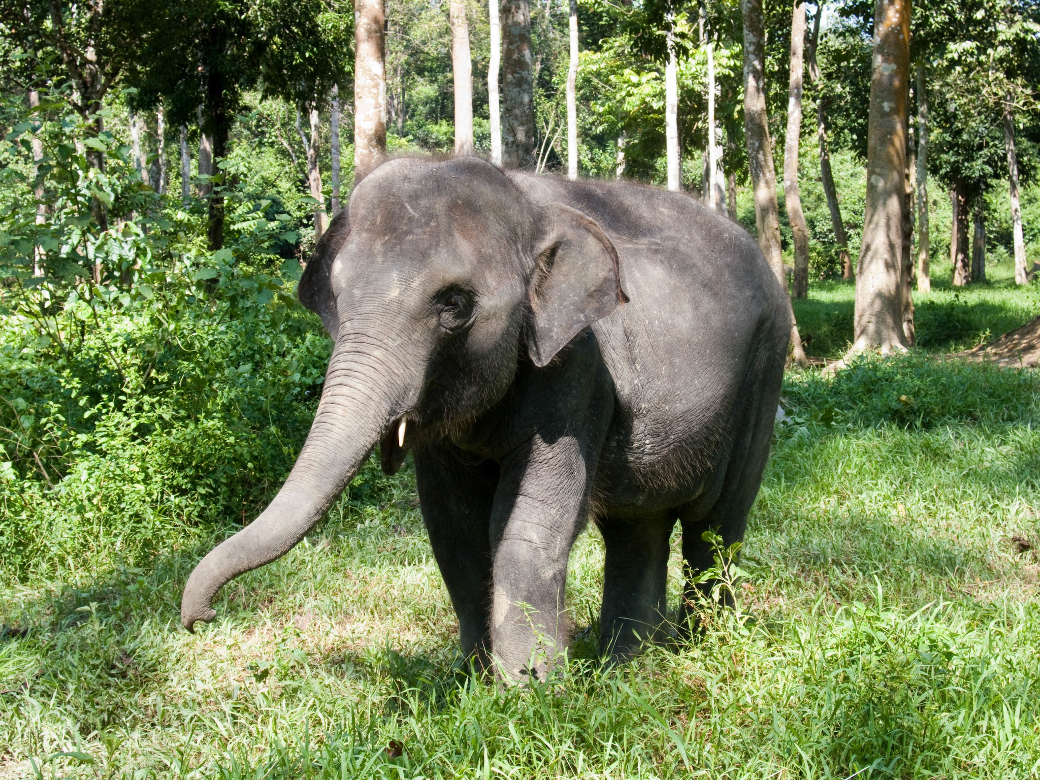
Elephants used to roam throughout the whole of Peninsular Malaysia. At present, only seven states in the peninsular still have isolated populations of elephants, with an estimated total of 1200 to 1500 individuals1.
|
|
The major causes of decline are forest clearance, land conversion for agriculture, and urban development. Roads cut off many travel routes and isolate elephant feeding grounds. So elephants are forced to encroach on human settlements and agricultural areas in search of food. This results in crop and property damage, and sometimes injury or death of humans. Affected people often want elephants to be translocated and may set out to kill problem elephants.
Elephants play an important role in maintaining the quality of our ecosystems and for the survival of other species:
We are currently working in the Endau-Rompin landscape in Peninsular Malaysia, straddling the border of Pahang and Johor. These uplands are an important catchment area for several rivers.
WCS Malaysia works with the Federal and State Department of Wildlife and National Parks to help to conserve wild elephants in the their habitats. WCS Malaysia believes that elephants and humans should co-exist in this landscape.
 |
|
Jessica training on MIKE “S” Dung Classification System. |
The first rigorous elephant population count in Peninsular Malaysia was carried out in Taman Negara early in 2007. The survey covered an area of 4,343 sq km using the CITES-MIKE Dung Decay Survey Method. Results indicated that 631 elephants remain in Taman Negara, making it the largest population of elephants known in Southeast Asia.
In the following year, mid-2008, field teams conducted the elephant count survey in the Endau-Rompin National Park and adjoining forest blocks, covering a total area of 2,500 sq km. An estimated 135 elephants live in the area.
In mid-2012, we started recording elephant trails around villages where elephants encroach into the crop and settlement areas, to map the areas and routes currently used by elephants.
 |
The government and commercial plantations have put up electric fences to keep out elephants. From mid 2011 to early 2012 our field teams walked along the electric fences to check on fence maintenance and gaps, and elephant signs along the fence.
We found that success of electric fencing depended on:
 |
|
Watchtower (above) and siren fence. |
 |
Since 2008, we have worked on ways to reduce human-elephant conflict. Some of the activities included:
Several training workshops have been conducted since 2007 in connection with our field activities, including:
 |
We have been invited by the Government to help develop the National Elephant Conservation Action Plan (NECAP). The Action Plan will address the threats to elephants and measures protect them for the future.
Several consultation workshops have taken place to discuss implementation, and a multi-agency stakeholder workshop with 60 participants is planned for 29 November – 1 December 2012.


1 Saaban, S., Othman, N., Yasak, M.N., Nor, B.M., Zafir, A. & Campos-Arceiz, A. (2011). Current Status of Asian Elephants in Peninsular Malaysia. Gajah 35(9):67-75

Malaysia’s National Tiger Conservation Action Plan identified three forested landscapes in the country as priority tiger landscapes: Taman Negara, Belum-Temenggor and Endau Rompin.
The Endau Rompin Landscape (ERL) (see map), located in the southern part of Peninsular Malaysia, has also been identified as one of the global tiger Source Sites [1]. The ERL covers a forested area of about 3,600 sq km and part of the Southern Forest Complex that forms the Central Forest Spine in Peninsular Malaysia.
In Johor, the landscape includes a contiguous forest (~2,500 sq km) from the Endau Rompin Johor National Park and Labis Permanent Reserve Forest (PRF) to Mersing PRF, Lenggor PRF, Kluang PRF and Ulu Sedili PRF. In Pahang (~1,100 sq km) , it includes the Endau Rompin State Park of Pahang, Sungai Pukin PRF, Endau PRF, Lesong PRF and Sungai Marong PRF.
|
|
The program commenced in 2007 and was aimed at protecting and increasing tiger numbers by 50% over a 10 year period. As part of this aim, all the prey species of tigers were also protected as it is with the prey that tiger numbers can recover.
The program in Johor is implemented under the Johor Wildlife Conservation Project (JWCP); a project initiated by the Johor government to conserve wildlife and forested habitats of the Johor Endau Rompin Landscape (JERL). The project was officially launched in June 2009 by DYMM Sultan Ibrahim Ismail Ibni Almarhum Sultan Iskandar, who is also the patron of the project which expanded to not just include tigers, but elephants.
The JWCP unites six agencies: Johor National Parks Corporation (JNPC, as the leading implementation agency), State Forestry Department of Johor (SFDJ), Department of Wildlife and National Parks (DWNP) of Johor, Royal Malaysia Police (RMP), Kulim (Malaysia) Berhad and WCS-Malaysia Program. WCS-Malaysia Program was invited by the state government to provide technical assistance and to carry out scientific research for the project. In 2011, the state government asked to expand the project coverage to include the forested area west of Linggiu Lake (~150 sq km), but the current land use of the area is not certain so it has not been officially included.
Our tiger and prey program in Pahang began in late 2010. The program is under the Pahang Forest and Wildlife Conservation Project (PFWCP), currently comprised of the State Forestry Department of Pahang, DWNP of Pahang and WCS-Malaysia Program. The focus is also on elephants and tigers. A similar biological and conservation target exists for tigers, i.e. an increase of the tiger population by 50% over a 10-year project period in the Pahang Endau Rompin Landscape (PERL).
An ad-hoc camera trapping survey was completed at the western part of the Endau Rompin Johor National Park to determine the presence of tiger and prey in the area. The survey not only confirmed the presence of tigers, but also potential prey species of tigers such as sambar deer, muntjac, common wild pigs, and tapirs. Bearded pigs, once thought to have become extinct or be in critically low number in peninsular Malaysia, have been frequently captured by our camera traps. A threat analysis of tigers and prey for Endau Rompin Johor National Park was also conducted.
A large scale prey-occupancy survey was completed in the JERL in a 5.5 months period, with a walking distance of approximately 3,280 km, and effort of about 4,500 survey-days. The forested area in the JERL surveyed was about 1,534 sq km, and at peak of the survey we had up to 40 field crews on the ground. Orang asli (indigenous people) from the Jakun community were part of the survey teams. The scale and area of the survey was the most intense and largest in recent scientific wildlife research history in Malaysia. It yielded the first ever occupancy maps of several tiger prey species in the country, namely sambar deer, tapir, pigs and muntjac.
After establishing preliminary findings of available prey species in the landscape, we carried out a population estimate of tigers in the northern part of the JERL with the DWNP using camera traps. The five-month survey in an area of 584 sq km was completed in early 2010 and a total of 41 camera trap sites were set up. The area covered during the camera trapping survey was the largest at the time in Malaysia, and the survey produced a preliminary analysis on density of tiger in the ERL.
In the same year, we introduced the Management Information System (MIST) as a tool to record enforcement patrols in the landscape, and initiated multi-agencies joint enforcement activities, such as foot patrols, vehicle patrols, static road blocks and mobile road blocks with JNPC and participated by all the partners under JWCP. The first multi-agencies patrol was carried out in June 2009. Since then, at least one joint multi-agency enforcement activity per month is carried out whenever possible. Johor became the first state to implement MIST for recording enforcement patrols in Malaysia.
Two JWCP enforcement trainings were also conducted to introduce MIST and other enforcement related modules to enforcement officers on the ground. Two specific trainings for Kulim Plantation’s security guards were completed to enhance knowledge to stop poachers and wildlife middlemen from passing through their plantations and reduce wildlife trafficking.

Corridor monitoring team search for wildlife signs along a road dividing Mersing PRF with Lenggor PRF and Ulu Sedili PRF. (Photo: WCS Malaysia Program)
After the population estimate of tigers in the northern part of JERL survey ended in early 2010, an ad-hoc camera trapping survey was implemented in the southern part of the landscape to determine the presence of tigers and prey in the area. 22 camera trap sites were set up and surveyed for six months. The survey not only yielded photographs of tiger and prey species but also some rare mammal species like otter civets.
Corridor monitoring was also conducted in late 2010 to survey use by wildlife of a road that separates Mersing PRF with Lenggor PRF and Ulu Sedili PRF. Survey teams were deployed on average once every two weeks to walk along the side of the road to record footprints, carcasses, scats and direct sighting of animals.
As for enforcement activities, two JWCP enforcement trainings on laws and enforcement technique were attended not only by all six JWCP’s stakeholders, but also State Forestry Department of Pahang, DWNP of Pahang and Sarawak Forestry Corporation. Monthly multi-agency patrols, road blocks or vehicle patrols were carried out throughout the year on detecting and preventing wildlife and forest related crime in the landscape.
Internationally, JWCP’s effort in protecting tigers was featured as a case study in the Global Tiger Summit in Russia by the Malaysian Minister of Natural Resource and Environment to showcase Malaysia’s effort in bringing tigers back.
In late 2010, WCS-Malaysia Program initiated discussions to start a similar conservation project in the Pahang side of the ERL with State Forestry Department of Pahang and the DWNP of Pahang. The first multi-agency joint patrol involving all three agencies was carried out in Pahang at the end of 2010. MIST was also agreed upon by the departments to be used as a common tool to record enforcement patrols during joint enforcement activities in Pahang.

WCS field team setting up camera trap. (Photo: WCS Malaysia Program)
A formal camera trapping survey of the whole JERL was implemented to obtain the population and density estimates of tiger. The reconnaissance survey of optimal camera trap sites was carried out for five months before and during the formal camera trapping for tiger population estimate. The formal camera trapping was completed in a five-month period and covered 2,500 sq km of the JERL. The field survey teams had up to 25 field staff at peak survey period. A total of 132 camera trap sites were set up across the JERL. The camera-trapped area was the largest done in Malaysia to date and the most intense.
The first phase of corridor monitoring was completed in 2011. Hot spots of wildlife crossings were identified and the information was given to relevant state departments for future policy or management use.
On the enforcement front, the Royal Malaysia Police who were initially only involved in road blocks started participating in the monthly foot patrols. More patrol and enforcement effort were put into areas of high snaring activities. Biological monitoring data were also used to prioritize the area to be patrolled.
In the Pahang Endau Rompin Landscape (PERL), more discussions and briefings were held to strengthen the collaboration among the agencies involved in the program. Multi-agency joint patrols were carried out whenever possible each month. Reconnaissance surveys of optimal camera trap sites commenced in late 2011 as part of an ad-hoc camera trapping exercise in the PERL. A threat analysis survey was completed in the PERL in 2011 in order to record the potential threats to tigers and other wildlife in the landscape.

Taman Negara National Park’s rangers learning MIST during a MIST training conducted by WCS and MYCAT SO. (Photo: WCS Malaysia Program)
Camera trapping surveys across the JERL landscape continue to be used as a means to monitor the presence and the number of tigers in the landscape.
More effort has also been put into the Phase Two of corridor monitoring. The corridor monitored this year is the bottleneck area near the Sungai Emas to Sungai Sembrong area, which connects the Labis PRF and Mersing PRF (see red-circled area in Figure 1). It is the main corridor connecting the northern and southern parts of the JERL. The corridor is also identified as the Primary Linkage 1 of the Central Forest Spine 2 of the southern peninsular Malaysia section. Latex timber clone rubber plantations are threatening to reduce the width of this corridor. The corridor monitoring records footprints, scats, carcasses, and direct sightings of animals.
Monthly multi-agency joint enforcement activities are on-going and more snaring hotspots have been identified in the JERL.
In the PERL, the ad hoc camera trapping started in March and more than 25 camera trap sites have been set up to determine the presence of tigers and prey species in the landscape. A social survey on the Orang Asli Jakun communities in Rompin district has been completed to record oral history on taboos, animal folktales and tradition of the community in the landscape to guide conservation strategies, and to document the culture of the local community that we work with.
Together with the Malaysia Conservation Alliance for Tigers (MYCAT) Secretariat Office, we work with DWNP on implementing MIST for patrols in Taman Negara starting 2011. By June 2012, three MIST trainings have been conducted for Taman Negara’s enforcement rangers. More trainings and patrols are planned for 2012.
Featured Image: provided by Koshyk under Creative Commons license.

90% of Sarawak’s orangutans are found in the protected area complex of Batang Ai National Park and Lanjak Entimau Wildlife Sanctuary (map). Together with the Betung Kerihun (Bentuang-Karimun) Nature Reserve across the border in Kalimantan, they form the largest protected area where the Bornean species of orangutan occur. The orangutans here are recognised as the northwest Bornean sub-species, Pongo pygmaeus pygmaeus.
Several short-term surveys of orangutans have been done in Sarawak, by George Schaller(1) in 1961, Mike Meredith(2) in 1993, Raleigh Blouch(3) in 2000, and Gurmaya and Silang(4) in 2002. Based on these surveys, the estimate for orangutans in Sarawak is about 1,300.
The Bornean orangutans are currently restricted to remote and less accessible areas but, even there, their population is threatened with extinction. The reasons for the decline include illegal hunting, habitat loss and lack of enforcement of the legislation that protects the species. These threats are very severe and have led to predictions that by 2020, less than 10% of Borneo’s total orangutan population will survive.
 Conservation education is a vital part of the orangutan project. WCS with partners including the Sarawak Forestry Corporation (SFC) engage local communities and schools to raise awareness and to develop a sense of ownership among them. This is carried out with the hope that there will be a change in the current “tragedy-of-the-commons” mentality in the next generation. More…
References:
1 Schaller, G.B. (1961). The orang-utan in Sarawak. Zoologica 46: 73-82.
2 Meredith, M. (1993). Draft Management Plan for Batang Ai National Park, 1993-1995. Wildlife Conservation Society, Kuching, Sarawak.
3 Blouch, R.A. (2000). Primates. In Soepadmo, E. & Chai, P (Eds.). Development of Lanjak Entimau Wildlife Sanctuary as Totally Protected Area: Scientific Report (pp 150-159). ITTO, Yokohama.
4 Gurmaya, K.K. & Silang, S. (2002). Development of Lanjak Entimau Wildlife Sanctuary as a Totally Protected Area. Phase III. A Study of habitat conditions, populations, and distribution of orang utan in Lanjak Entimau Wildlife Sanctuary and Batang Ai National Park, Sarawak, Malaysia. ITTO, Kuching.
PDF Version

MESYM.com is a crowd-sourced platform and a living database for environmental movements in Malaysia. There are many good actions being done out there. Our goal is to bring them together. We connect the green dots.